Lakefront RV Park Map with Numbered Sites and Amenities
A full-park RV map with color-coded areas, numbered sites, a lake and a clear amenity legend, delivered as editable vector files.
- Type of work
- RV park map
- Delivered
- Editable vector files
- Made for
- Website, print and signs
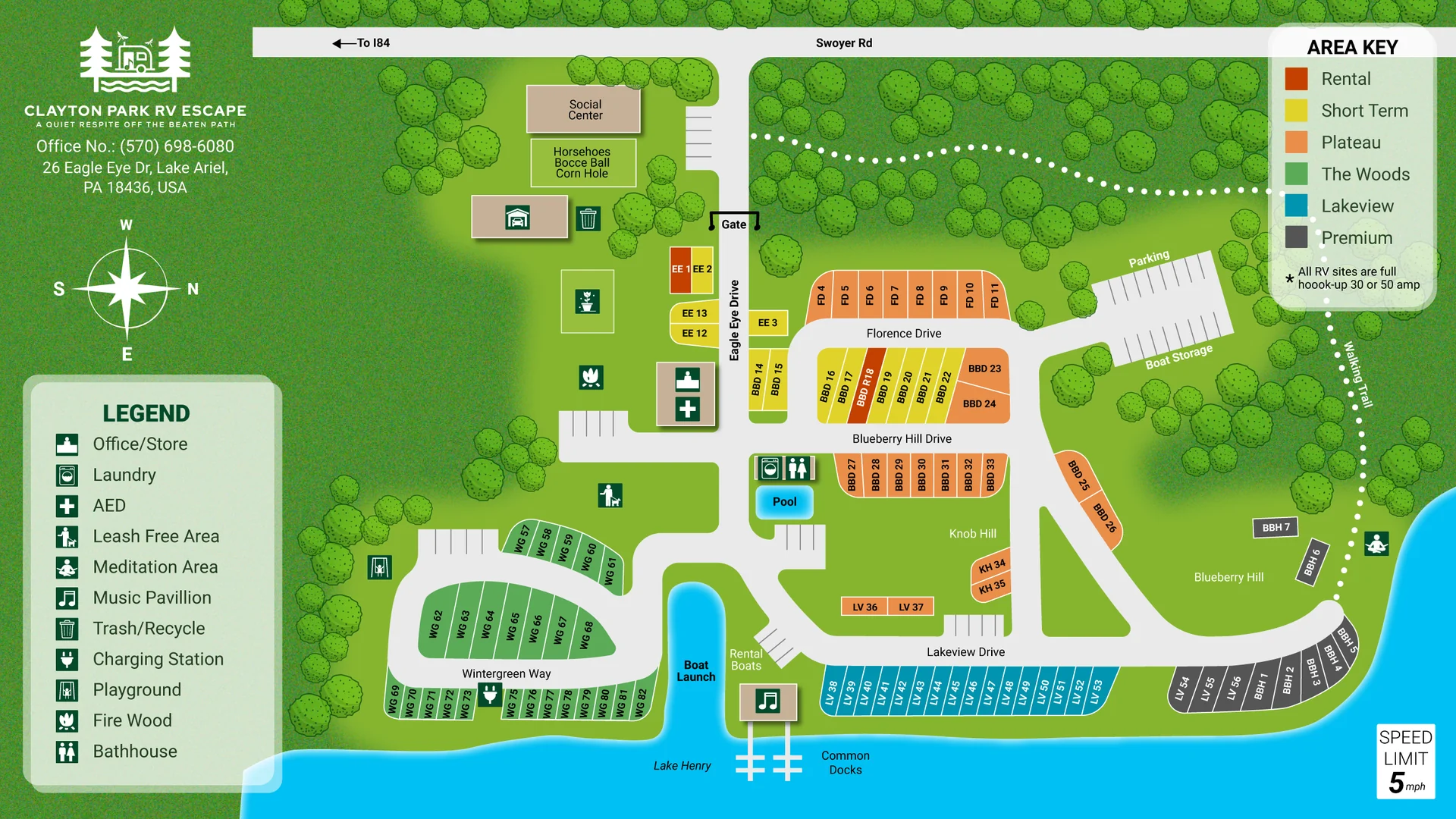
This is a full-park map for an RV resort beside a lake. Guests need to see where each site is, which area it belongs to and where the shared amenities are. So the map is built around three things: a clear road network, color-coded areas and a legend that is easy to scan.
What is on the map
- Every RV site drawn in its place along the loops, each with its own number
- Color-coded areas (Rental, Short Term, Plateau, The Woods, Lakeview and Premium) so guests can find the right section at a glance
- Named roads and drives, a walking trail and the park gate
- The lake, a boat launch, common docks and a pool
- A legend with icons for the office, laundry, AED, leash-free area, meditation area, music pavilion, playground, firewood, bathhouse and more
- A compass, a speed-limit sign and a note that all RV sites are full hook-up
How a map like this is made
I start from what you already have: a survey, a CAD file, a Google Maps screenshot, an old printed map or a rough sketch. I draw the roads, water, buildings and labels by hand in Adobe Illustrator, then build the legend and key. You review a first draft, and I make the revisions until it is right.
What you receive
Editable vector files you own and can update later, plus print-ready and web-ready versions. Because the map is vector, it stays sharp on a website, a brochure or a large sign.
Need a map for your own property? Send me your details and I will reply with a clear quote and timeline.