Maps
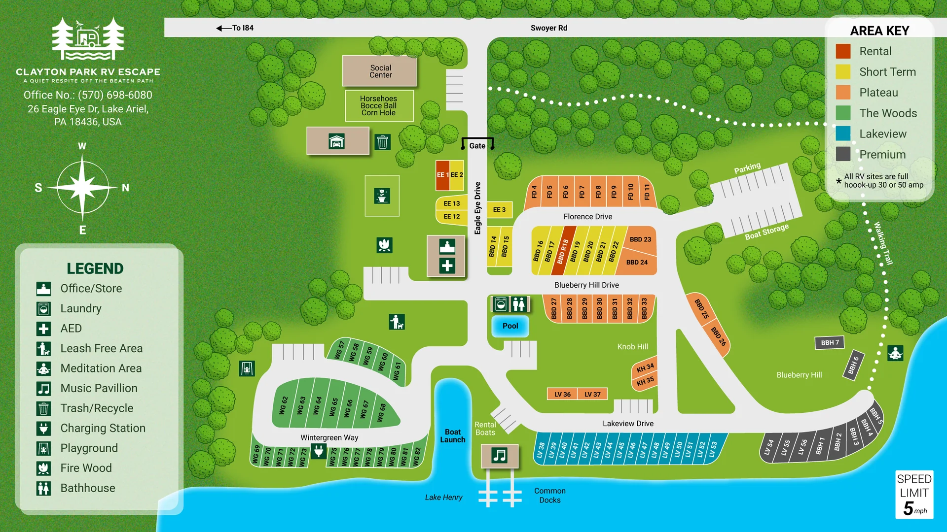
Lakefront RV Park Map with Numbered Sites and Amenities
A full-park RV map with color-coded areas, numbered sites, a lake and a clear amenity legend, delivered as editable vector files.
Portfolio
A closer look at maps and figures I have drawn: what is on each one, and what you receive.
A full-park RV map with color-coded areas, numbered sites, a lake and a clear amenity legend, delivered as editable vector files.
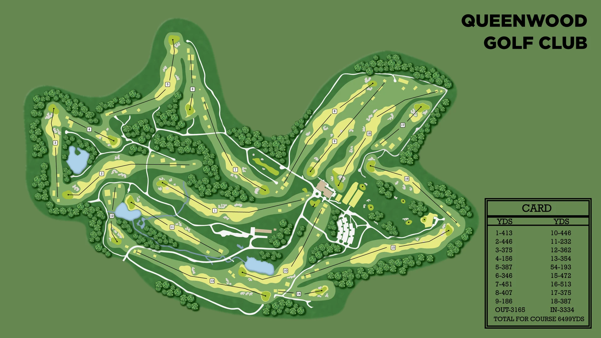
A full-course golf map showing every hole, fairway and green, with a yardage card, made for signs, scorecards and websites.
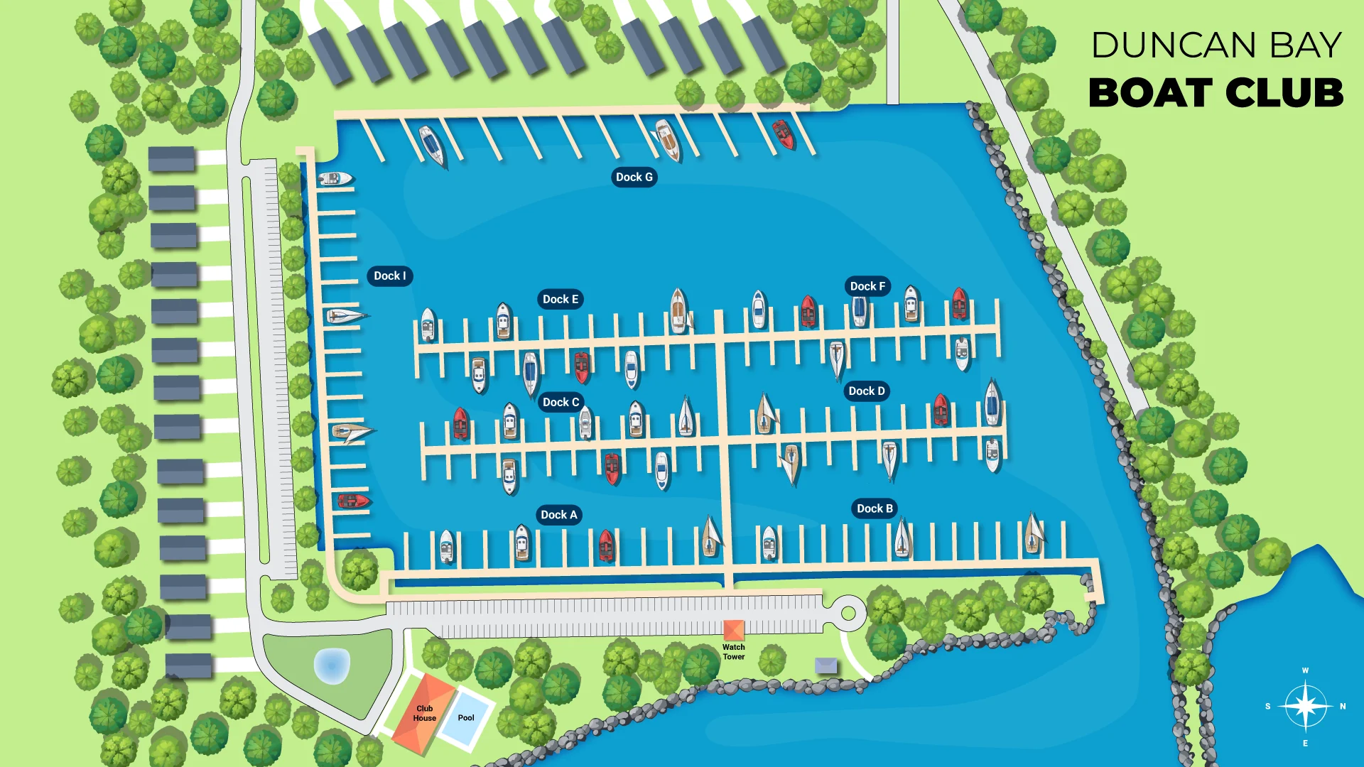
A top-down marina map with labeled docks, boats in their slips, storage buildings and a watch tower, drawn in a clean illustrated style.
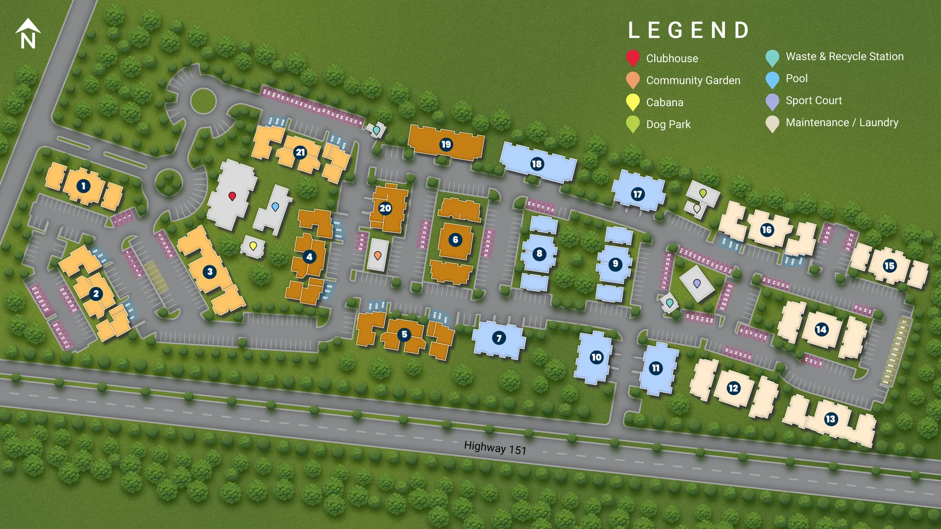
A site plan with numbered, color-coded buildings, parking, roads and an amenity legend, ready for sales offices, brochures and websites.
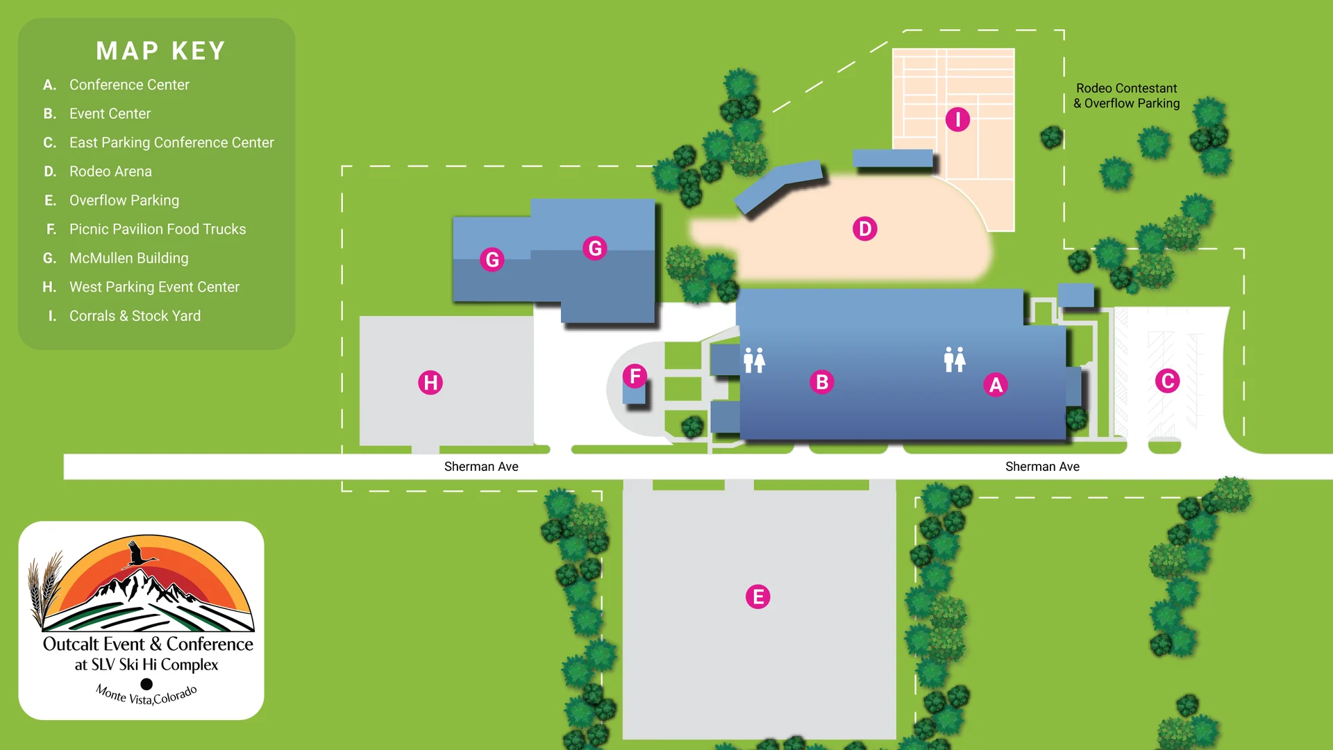
A venue map for a conference and event complex, with lettered locations, parking areas and a map key that visitors can read at a glance.
A low-resolution grouped bar chart rebuilt as a sharp, fully editable vector figure with clean text, aligned bars and labeled values.
A two-part medical figure showing how insulin helps glucose enter muscle and how white blood cells move out of a blood vessel, in one consistent style.
Tell me about your project and I will reply with a clear quote and timeline.