Residential Community Site Plan with Numbered Buildings
A site plan with numbered, color-coded buildings, parking, roads and an amenity legend, ready for sales offices, brochures and websites.
- Type of work
- Real estate site plan
- Delivered
- Editable vector files
- Made for
- Sales offices, brochures and websites
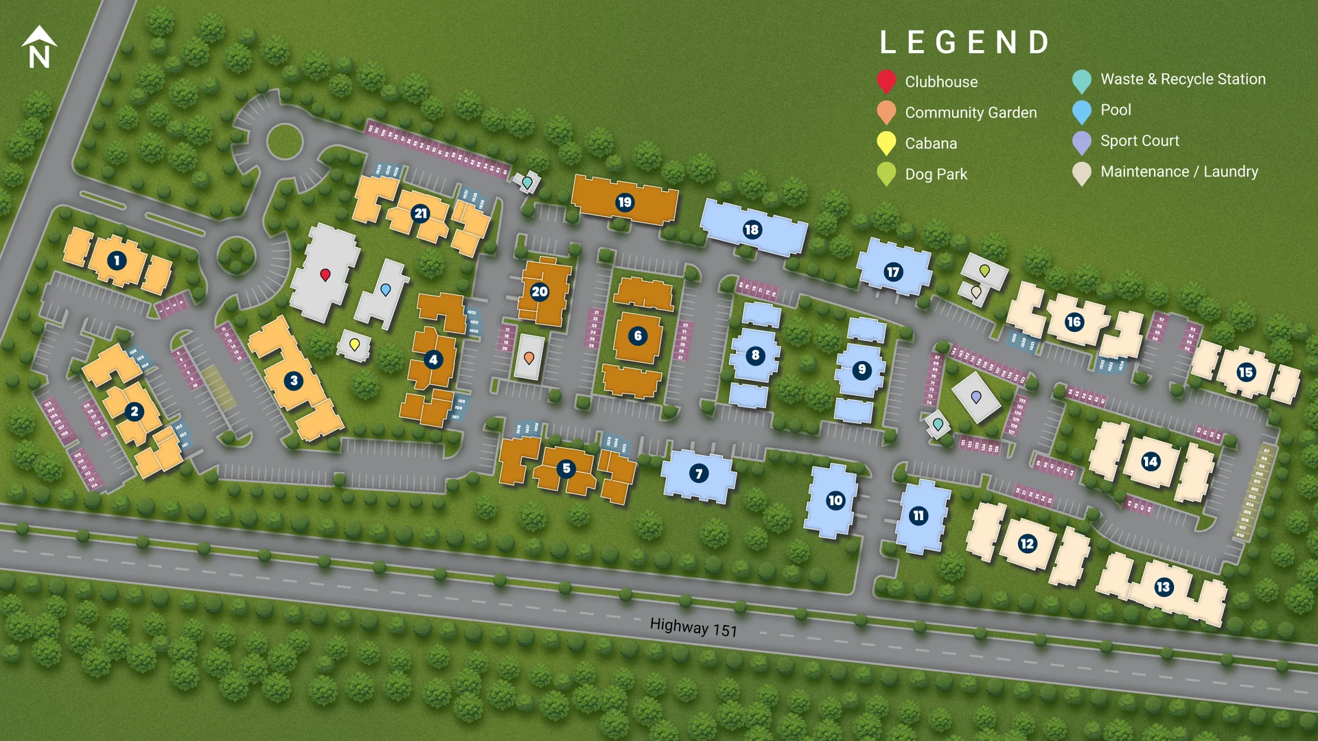
A buyer or tenant looking at a development wants to know where each building is and what is nearby. This site plan gives every building a number and shows the amenities in a simple legend, so the layout is understood in seconds.
What is on the map
- Numbered buildings in two colors, so groups of buildings are easy to tell apart
- Roads, parking areas and landscaping around each building
- A legend for the clubhouse, community garden, cabana, dog park, waste and recycle station, pool, sport court and maintenance and laundry
- A north arrow and the nearby highway for orientation
Where it is used
Site plans like this are used in sales offices, brochures, leasing websites and on-site signs. The same artwork can be updated when buildings are added or sold.
How a map like this is made
I start from what you already have: a survey, a CAD file, a Google Maps screenshot, an old printed map or a rough sketch. I draw the roads, water, buildings and labels by hand in Adobe Illustrator, then build the legend and key. You review a first draft, and I make the revisions until it is right.
What you receive
Editable vector files you own and can update later, plus print-ready and web-ready versions. Because the map is vector, it stays sharp on a website, a brochure or a large sign.
Need a map for your own property? Send me your details and I will reply with a clear quote and timeline.